If you still think navigation is a choice between paper charts and a glowing screen, the water will correct that idea for you eventually. Modern sailing works best when traditional seamanship and e-navigation tools support each other.
When I look at the way sailors plan a passage now, the same questions keep appearing: What does e-navigation actually mean? Which classic skills still matter? How much trust should go into a chartplotter or GPS app? And what should a skipper check before leaving the dock? The International Maritime Organization frames e-navigation as the coordinated use of marine information and digital systems to improve safety and decision-making, while the Royal Yachting Association still teaches the fundamentals of navigation as a core sailing skill.
This matters because modern navigation is no longer just a matter of one tool replacing another. The real question is how to combine charts, bearings, tides, position fixing, and route planning with digital chart systems, AIS overlays, and integrated bridge data. You can see the broader navigation standards and charting context on the IMO’s safety of navigation page and its guidance on ENC and ECDIS.
By the end of this article, you will have a practical way to think about navigation at sea: what to keep sharp on paper, what modern tools do well, where e-navigation helps, where it can mislead, and how to build a simple pre-departure routine that reduces avoidable mistakes.
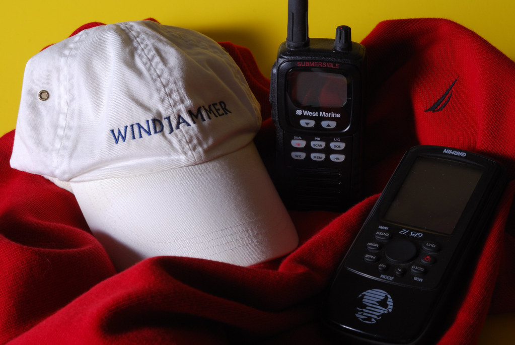
Traditional navigation skills that still earn their keep
Some skills become less fashionable and then quietly save the day. Navigation is one of them. A sailor who can read a paper chart, identify a bearing, estimate position, and understand tide effects is not being nostalgic; that sailor is preserving the ability to think when the screen goes dark or the signal gets messy.
The RYA’s Introduction to Navigation is a useful reminder that the basics are not beginner-only trivia. They are the backbone of safe passage planning. The core building blocks are straightforward:
- Charts for understanding coastlines, depths, hazards, and marks.
- Bearings for confirming direction and cross-checking position.
- Position fixing using visual references, compass bearings, or electronic fixes.
- Tides and currents for timing arrivals, clearing shallow water, and correcting course.
- Route planning so the passage is thought through before the boat leaves the berth.
In practice, this means the skipper is never depending on one neat answer. A buoy, a headland, a range line, and the depth sounder may all tell the same story in slightly different accents. That is the point. Good navigation listens for agreement.
What e-navigation changes, and what it does not
E-navigation is often described as the digital layer on top of marine safety and charting. The IMO’s current navigation work continues to emphasize interoperable data, electronic charts, routeing, and the slow but important shift toward the S-100 family of products. In plain language, the sea is becoming more data-rich, not magically simpler.
Useful digital tools now commonly include chartplotters, mobile navigation apps, AIS receivers, radar overlays, and integrated instruments that share heading, wind, depth, and position data. Those systems are genuinely helpful. They reduce workload, improve visibility in poor conditions, and make route planning faster. They also create a tempting illusion: if the map is moving and the numbers look precise, everything must be under control. Not quite.
That is why I recommend thinking of e-navigation as an aid to judgment, not a substitute for it. The technology can show more information than a paper chart ever could, but it still depends on the human being who decides whether the information makes sense.
How sailors combine paper and electronic methods
The most reliable approach is redundancy with discipline. I do not mean carrying a drawer full of gadgets and calling it resilience. I mean using two methods that can verify each other.
| Task | Paper method | Electronic method | Why both matter |
|---|---|---|---|
| Route planning | Chart, compass, tide table, visual waypoints | Chartplotter, route app, weather overlay | One reveals context; the other speeds adjustments |
| Position checking | Bearing to landmarks, depth, range lines | GPS fix, AIS, radar target matching | Cross-checking reduces false confidence |
| Hazard awareness | Charted rocks, shallows, marks | Digital chart layers, alarms, track history | Layers help, but the chart remains the baseline |
| Backup plan | Paper chart accessible on deck | Spare power source, phone or tablet backup | One outage should not end the passage |
A practical habit is to mark the route on paper before departure and then load the same route into the electronics. If the two disagree, stop and investigate. That pause is not delay; it is seamanship.
For sailors who want a good refresher on the broader navigation landscape, the IMO pages on e-navigation and safety of navigation are clear entry points. They are not recreational how-to manuals, but they explain why the industry keeps moving toward more harmonized digital information.
Common mistakes when the screen gets too much authority
Most navigation mistakes are not dramatic. They are small, repeated assumptions. The trouble starts when those assumptions are never challenged.
- Trusting GPS blindly without checking whether the plotted position matches the visible world.
- Ignoring tide and current because the chartplotter makes the route look clean.
- Letting autopilot erase attention during the exact moments when traffic, weather, or landfall need review.
- Failing to update charts or software before a trip, especially on longer coastal passages.
- Not testing backups so the first time the main screen fails is during a real departure.
The useful lesson is simple: digital precision is not the same thing as situational awareness. A line on a screen can be accurate and still be poorly interpreted. Mariners have been getting into trouble with perfectly good numbers for a very long time. Technology merely makes the numbers more cheerful.
A practical pre-departure navigation checklist
Before a recreational sailing trip, I would keep the routine short, repeatable, and boring in the best possible way. Boring pre-departure checks are often the reason the rest of the trip is interesting instead of memorable for the wrong reasons.
- Check the latest weather and visibility forecast.
- Confirm the route on both paper and the chartplotter.
- Review likely hazards, tides, and departure timing.
- Set up waypoints and cross-check them against the chart.
- Make sure the compass, GPS, and depth sounder all agree roughly with the plan.
- Carry a charged backup device or power option.
- Keep the paper chart accessible, not buried under comfortable clutter.
- Tell someone your intended route and return window.
If you sail regularly, this list becomes a habit. If you are new to it, put it beside the kettle and pretend it is a tradition. Traditions are just habits with better branding.
Where this fits into modern seamanship
Navigation is not disappearing into software. It is becoming more layered. That is actually good news for sailors willing to learn both the old grammar and the new syntax. Traditional skills keep you oriented when conditions change. Digital tools give you speed, integration, and better warning systems. Together, they make a skipper harder to surprise.
If you want a broader look at how sailing knowledge connects across gear, learning, and life on board, you can also explore Life on Board, browse more articles in the blog, or read about the team behind the site on About. For direct questions, the Contact page is the place to start. And if you are curious about the captain’s perspective on seamanship and decision-making, Captain Nazan is worth a look.
Key takeaways
- Traditional navigation still matters because it gives sailors judgment, redundancy, and situational awareness.
- E-navigation improves safety and convenience when used as a support system, not a replacement for seamanship.
- Paper and electronic methods work best together when each is used to verify the other.
- Good habits before departure reduce the chance that a screen issue becomes a trip issue.
- Confidence at sea comes from practice, not from trusting the brightest display on the boat.
For readers who want to keep learning, the most useful next step is simple: review one passage plan with paper first, then build it again on the electronics and compare the two. That comparison tells you more than a hundred confident icons ever will.